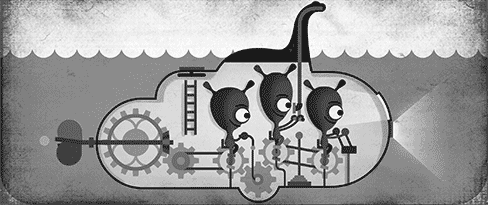
Myth or monster? Explore Loch Ness with Street View

Like the world’s best legends, the Loch Ness Monster transcends the everyday and exists at the edges of possibility. It rises above the sightings and the hoaxes; the claims and counter-claims; the tourism, the nationalism—and even the assassination plots. It lives in the telling of stories. Whether or not you believe, most people hold a romanticized vision of the creature that, legend has it, plumbs the depths of the Loch. Affectionately known as “Nessie,” she exists in folklore, dances in childrens’ imaginations, and seeps into our society and teachings, inspiring everything from pop music to pop culture to pulp fiction.
In 1934, the “Surgeon’s Photograph” was released, claiming to show the monster in the misty waters of the lake. It’s the most iconic photo in the history of Loch Ness—and may be one of the most elaborate hoaxes of our age. Today, to celebrate the anniversary of its release, we're bringing 360-degree Street View imagery of Loch Ness to Google Maps, so you can go in search of Nessie yourself.
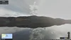
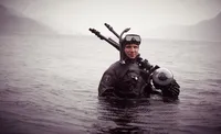
Sail across the freshwater lake and take in its haunting beauty, made darker still by the peat particles found in its waters. Let the Loch unlock the spirit of your imagination, where the rippling water, tricks of the light, and drifting logs bring the legend of Nessie to life. Adrian Shine, leader of the Loch Ness & Morar Project, has been engaged in fieldwork in the Highlands since 1973 and was an integral part of the Street View collection. As a true Loch Ness expert, Shine has logged more than 1,000 Nessie sightings and offers scientific explanations for why people claim to have seen Scotland’s mysterious cryptid.

Explore Loch Ness in Google Maps
Formed of a series of interrelated bodies of water, including the River Oich to the south and the Bona Narrows to the north, Loch Ness stretches for 23 miles southwest of Inverness. Although it’s neither the largest Scottish loch by surface area nor depth, it is the largest by volume, containing more freshwater than all the lakes of England and Wales combined. And at almost 800 feet deep, there’s an entire world below the surface, giving rise to the Nessie legend.

To take you on a tour of what lies beneath, our partners at the Catlin Seaview Survey dived deep under the surface of the lake, collecting imagery along the way. You can imagine Nessie nestling within these dark, peat-filled waters, waiting for the right moment to breach the surface into the Scottish sunlight above.
Wherever you stand on the Nessie debate, the legend lives on—even in the digital era. There are more searches for Loch Ness than there are for other U.K. institutions like Buckingham Palace and the Peak District. And as we celebrate Loch Ness with today’s Doodle, we hope you can enjoy some of the most history-laden and breathtaking imagery the highlands have to offer with Street View in Google Maps.