Hot off the Satellite: Burning Man 2010
September 3, 2010
For all you “Burners” out there (or those of us who wish we could go this weekend), we’ve just published imagery from Burning Man 2010, captured Wednesday, September 1st by GeoEye’s GeoEye-1 satellite. This annual event, taking place in Nevada’s Black Rock Desert, celebrates both human individuality and togetherness, highlighted by the ritual burning of a large wooden effigy (“The Man”) Saturday evening. You can find the location of the “The Man” in the center of the annually-built tent city, shown below.
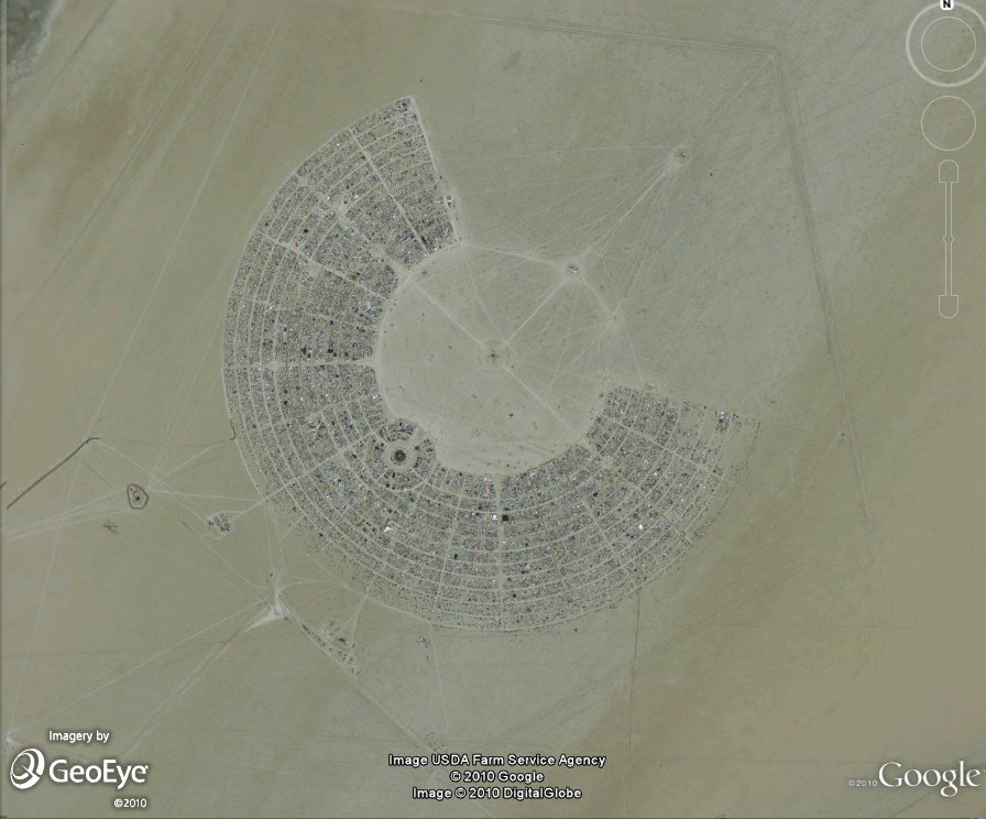

Black Rock Desert tent city (left)
Location of “The Man" (right)
To view this great new Burning Man imagery in Google Earth, select the 'GeoEye Featured Imagery' button located in the Google Earth 'More' folder:
 Also, if you’re headed out to Burning Man this weekend, be sure to check out this KML from Google Earth Community user “Portaplaya,” which provides a Burning Man street map.
Posted by Pete Giencke, GIS Data Engineer


 Follow
No comments :
Post a Comment
Note: Only a member of this blog may post a comment.